GRASS GIS 7.4

Free Contains over 350 modules to render maps and images on monitor and paper
Rating
Your vote:
Latest version:
8.2.1 See all
Screenshots
1 / 3
Awards (1)
Show all awards
Software Informer Virus Free award
Download
Free   155 MB

Geographic Resources Analysis Support System, commonly referred to as GRASS GIS, is a Geographic Information System (GIS) used for data management, image processing, graphics production, spatial modelling, and visualization of many types of data. It is Free (Libre) Software/Open Source released under GNU General Public License (GPL) >= V2. GRASS GIS is an official project of the Open Source Geospatial Foundation.

GRASS GIS supports workgroups through its LOCATION/MAPSET concept which can be set up to share data and the GRASS installation itself over NFS (Network File System) or CIFS. Keeping LOCATIONs with their underlying MAPSETs on a central server, a team can simultaneously work in the same project database.

Comments

User

Your vote:

Related software

GRASS
GRASS
Free
rating

Free and open source Geographic Information System (GIS) software.

Raster to Vector
Raster to Vector
rating

Convert raster image formats to DXF, HPGL, EMF, and WMF.

VeryPDF Raster to Vector
rating

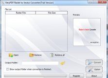
Raster to Vector Converter is used to convert raster files to vector files.

Quantum GIS
Quantum GIS
Free
rating

Provides a continously growing number of capabilities provided by core functions

Geospatial Toolkit
Geospatial Toolkit
Free
rating

NREL-developed map-based application.

Tags

Image processing Raster analysis Spatial modeling Vector analysis Geospatial analysis Geospatial data Data management